Mountains, Plateau, & Plains Worksheets For Grade 5
Mountains, plateau & plains worksheets for grade 5 students cover different topics related to geography of India namely, plains, mountains, plateau, ghats, and water bodies like rivers etc.. Each social science or geography worksheet on this topic listed below contains 5 individual worksheets with unique questions. The answers to all worksheets are also available to download as a separate file on the bottom of the page.
📚 Upgrade to the Grade 5 EVS Workbook Series
Avoid printing loose sheets individually. Choose a structured approach tailored to your child's exact academic goals:
Comprehensive Workbooks: Covers the entire syllabus sequentially with 2 worksheets per topic. Ideal for full-term revision.
Chapter-Wise Workbooks: Deep-dives covering specific chapters with ~5 worksheets per sub-topic for concept mastery.
Workbook Bundles: Get the complete collection of all chapter workbooks grouped together in 1-click for maximum value.
India has different types of mountains. The Himalayas in the north are fold mountains formed by the collision of tectonic plates. The Aravalli Range in Rajasthan is also a fold mountain but very old. The Western and Eastern Ghats run along the coasts. The Vindhya and Satpura ranges are in central India. India does not have major volcanic mountains, but the Barren Island in the Andaman and Nicobar Islands is volcanic. Block mountains like the Vindhyas are formed by cracks in the Earth’s crust. These mountains influence climate, provide water, and support forests, wildlife, and farming.
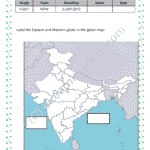
India has two main coastal plains: the Eastern Coastal Plain and the Western Coastal Plain. The Eastern Coastal Plain is along the Bay of Bengal, stretching from West Bengal to Tamil Nadu. The Western Coastal Plain is along the Arabian Sea, from Gujarat to Kerala, and includes the Konkan Coast, Kannada Coast, and Malabar Coast. The Western Ghats and Eastern Ghats are mountain ranges near these plains. The Western Ghats are higher and more continuous, covering Maharashtra, Karnataka, and Kerala. The Eastern Ghats are lower and spread across Odisha, Andhra Pradesh, and Tamil Nadu. These areas have many plants, animals, and fertile land, which help farming and nature.
India has many plateaus and rivers. The Deccan Plateau is the largest, covering states like Maharashtra, Karnataka, and Telangana. The Chotanagpur Plateau in Jharkhand is rich in minerals. The Malwa Plateau lies in central India, and the Meghalaya Plateau is in the northeast. Major rivers include the Ganga, which is the longest, the Yamuna, a major tributary, and the Brahmaputra, which flows through Assam. The Godavari, Krishna, and Kaveri are important south Indian rivers. The Narmada and Tapi flow westward into the Arabian Sea. These rivers provide water for farming and daily use. The plateaus have minerals, forests, and fertile land, making them important for India.
There are a few workbooks that cover all topics on mountains, plateau, plains & rivers for class 5 and more. You can purchase these workbooks instead of downloading individual worksheets.